- Details
- Category: Geodesy at Turner Farm
Ryan A. Hardy, Ph.D. & Robert L. Kellogg, Ph.D.
Which way is up? It’s a seemingly simple question, but one that is fundamental to mapping our planet. Intuitively, “Up” is defined by local gravity, the opposite of the direction of plumb bob hangs. Earth’s irregular curvature means this direction changes depending on where you are. Mapping how this direction changes across Earth’s surface can yield the planet’s shape, which is a fundamental goal of the science of geodesy.

The Turner Farm Observatory Park was the site of several types of geodetic observation that contributed to the development of the global geodetic system. They played a role as reference points for observations that resulted in the creation of the reference system used for the Global Positioning System (GPS). This system enables geodetic observations that help us know where we are, understand the shape of our continents, measure sea level rise, and detect land motion from earthquakes.

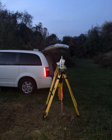
Continuing Observatory Park’s legacy as a geodetic facility, surveyors from NOAA’s National Geodetic Survey[1] visited in November 2020 to conduct astronomical observations. The purpose of this visit was to test the Total Station Astrogeodetic Control System (TSACS)[2], an instrument package that captures images of stars and returns a precise answer to the original question, “Which way is up?”
Historical geodetic measurements at Observatory Park were primarily conducted by two government offices that have gone by different names over the years. The Coast & Geodetic Survey became the National Geodetic Survey (NGS) after the creation of NOAA in 1970, while the Army Map Service (AMS) became the Defense Mapping Agency (DMA), and later the National Geospatial Intelligence Agency (NGA).
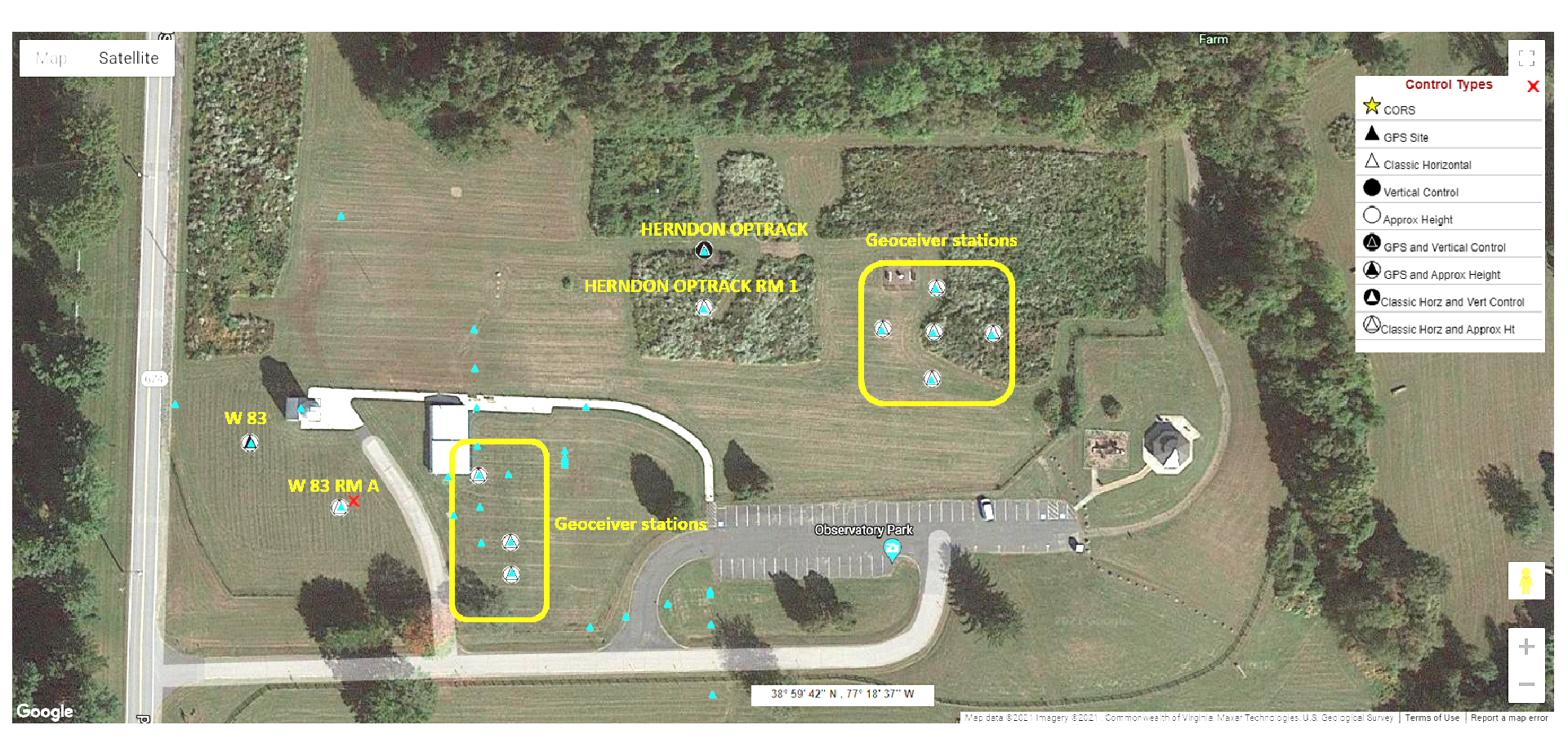
Observatory Park was once part of the W-83 Nike missile defense site for Washington, D.C. (Look for the W 83 marks in the Google Map above). The site consisted of two parcels of land: one for launch, and one for fire control. Observatory Park was part of the fire-control component, while what is now Great Falls Nike Park, a kilometer to the southwest, served as the launch site. After the decommissioning of the Nike facility in 1961, AMS transformed the site into a geodetic observing facility.
Observatory Park is among a number of sites in the Washington metropolitan area with significance to the history of geodesy. Many of these sites have historical astronomical observations that could be used to check present-day astronomical measurements made by TSACS. Many of these observations were made in the 1960s or earlier and vegetation growth rendered many of these sites unsuitable for astronomical observations. Observatory Park, with its many surviving geodetic monuments and unobstructed skies, was an ideal site for this type of observation.
What is Geodetic Astronomy?
Read more or download the attachment to see the important work done here at the Herndon Station at Turner Farm Observatory Park.

